
Google Maps is adding an interesting new feature that is an unfortunate sign of the times. This as an Air Quality Index (AQI) is being added to the mix for both the Android and iOS versions of the app.
As Google explains, this feature is being rolled out not only for those who want to breathe in as fresh air as possible while venturing outdoors, but also to serve as a visualisation of just how poor air quality is in some regions.
Sadly this feature is limited to the United States for now, so it remains to be seen if the likes of China and India will get something similar, as both BRICS nations are some of the worst offenders when it comes to air pollution.
“You’ll see Air Quality Index (AQI), a measure of how healthy (or unhealthy) the air is, along with guidance for outdoor activities, when the information was last updated, and links to learn more,” explained Google in a blog post.
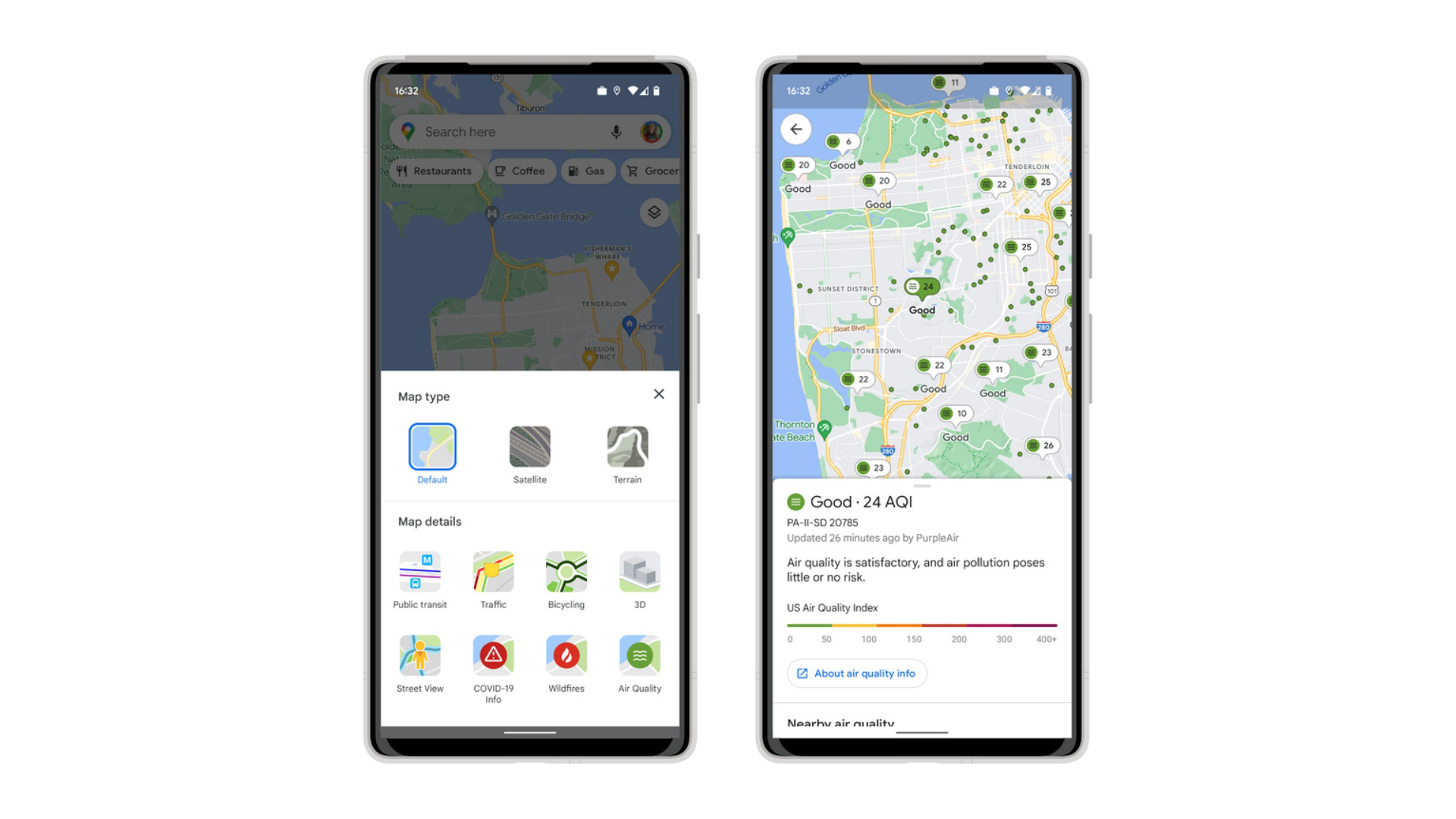
“The air quality layer shows trusted data from government agencies, including the Environmental Protection Agency in the U.S. We are also showing air quality information from PurpleAir, a low-cost sensor network which gives a more hyperlocal view of conditions. To add the air quality layer to your map, simply tap on the button in the top right corner of your screen, then select Air Quality under Map details,” it adds.
The AQI feature is not limited to Google Maps screens either, with the company adding that, “You can also view air quality information from PurpleAir on Nest displays and speakers. The broad coverage of PurpleAir sensors means significantly more people in the U.S. will be able to access vital air quality information directly from their Nest devices.”

