
- Google has launched the new FloodHub, an updated platform that tracks flooding using satellite data and AI.
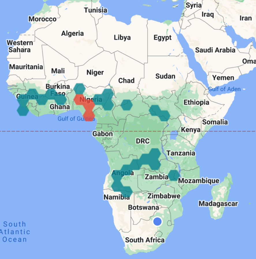
- The platform now covers 16 African countries including South Africa and Nigeria.
- As natural disasters like floods become more common due to climate change, Google wants to keep more people informed to mitigate the loss of life.
As natural disasters caused by climate change are set to disproportionally affect Africa, Google has announced that it has expanded its AI-powered warning system for floods to 18 more developing countries with the launch of a new tracking platform.
New additions include South Africa, Nigeria, Namibia, the Republic of Congo, Cote de Ivoire, Cameroon, Ghana, Malawi, Angola, Guinea, Chad, Burkina Faso, Sierra Leone, Liberia and South Sudan.
Floods claim thousands of lives every year. We use satellite imagery and AI to accurately map rivers, model what areas will be flooded, and send timely info (https://t.co/nrsN6z6C1T)
Today, we’re announcing the expansion of flood forecasting coverage to 18 new countries. (2/5) pic.twitter.com/q6l2g5e3Qk
— Google AI (@GoogleAI) November 2, 2022
Additionally, Brazil and Colombia in Latin America and Sri Lanka in Asia have been included.
African governments are being advised by climate change bodies to begin bracing their people for natural disasters like floods coming at increasing frequency.
This year South Africa faced its worst flood in generations as climate change funnelled what some have called the country’s “deadliest storm on record” upon KwaZulu-Natal. Across two days in April, 489 people lost their lives and a further 40 000 people were displaced as the rushing water ruined thousands of homes and livelihoods.
South Africa’s government estimated the damage caused by the flooding in the province to be over R25 billion.
Damage to private companies is estimated at around R7 billion with around 68 percent of jobs in eThekwini reportedly affected.
Google says that “Floods claim thousands of lives every year. We use satellite imagery and AI to accurately map rivers, model what areas will be flooded, and send timely info.”
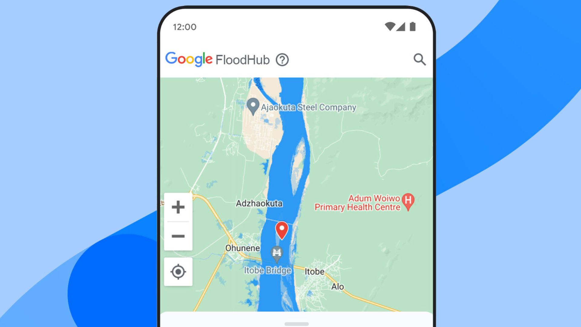
Called Google FloodHub, the platform shows what regions are being affected by flooding. For example, a cursory look at the time of writing indicates that there is currently flooding across West Africa (blue), with dangerous water level warnings being issued in Nigeria (red).
Nigeria has been dealing with some of its worst flooding in history in recent weeks. The developing economy has been overwhelmed by the scale of the disaster that has taken the lives of over 600 people.
The FloodHub platform “displays flood forecasts and shows when and where floods may occur to help people directly at risk and provide critical information to aid organizations and governments,” writes Yossi Matias, VP Engineering, Research and Crisis Response lead at Google in an official blog post.
“This expansion in geographic coverage is possible thanks to our recent breakthroughs in AI-based flood forecasting models, and we’re committed to expanding to more countries,” Matias adds.
According to the FloodHub training video, the app allows people who are already in flooded areas to provide flood water depth data to Google so it can improve its AI models with real-time data.
The platform shows a map of your area that includes information about regions with dangerous levels of flooding as well as flooding forecasts “which is usually up to a couple of days in the future.”
Locations that you want to keep track of can be marked as “Favourites” using a star at the bottom of your smartphone screen.
Google is also adding AI-tracking systems for other natural disasters such as wildfires and hurricanes using satellite imagery.
“Natural disasters are increasing in frequency and intensity due to climate change. As part of our Crisis Response efforts, we’re working to bring trusted information to people in critical moments to keep them safe and informed,” concludes Matias.
[Image – Google on Twitter]

